Archifdy Ceredigion Archives
MUSEUM COLLECTION
Acc. 2645
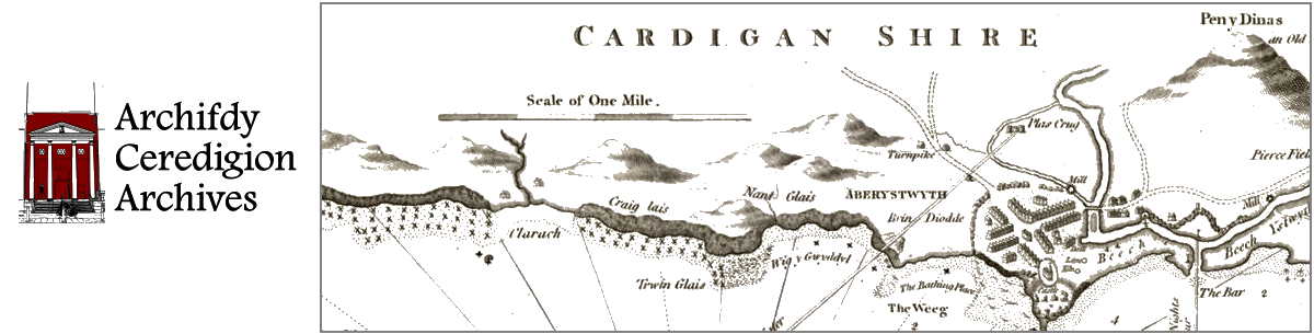
Ref: MUS/121 Engraved map of SW WalesMUS/121/1 ‘Map of the South West Circuit of the Principality of Wales comprising the Counties of Cardigan, Pembroke and Carmarthen, from Actual Survey made in the Years 1832 and 1833 by C. & J. Greenwood, Published by the Proprietors, Greenwood & Co. 3 Burleigh Street, Strand, London. Corrected to the present period and published April 1st 1834’.
Engraved by J & C. Walker. Original wash colouring. View of St. David’s Cathedral in bottom right corner.