Archifdy Ceredigion Archives
ACM: Early maps of Cardiganshire
Acc. 3392
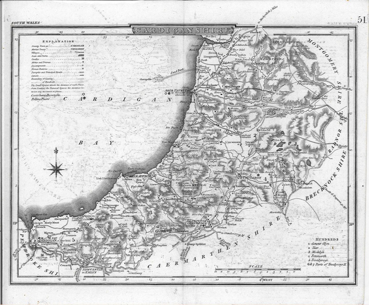
Ref: ACM/64-68A NEW SURVEY?ACM/64G. Cole and John Roper, 'Cardiganshire' (1809), in
The British Atlas (1810). Shows roads, division of hundreds, principal places, rivers, seats and, for the first time, antiquities, including the Roman fort at Llanio, with keys. Relief depicted with hachuring. Coloured
Shows several additional routes to those depicted on Kitchin's county map (ACM/57) and numerous novel places, including inns such as Tafarn Fach (now Taliesin), and parks at Llanerchaeron, Ciliau Aeron and Hafod, in addition to that at Trawscoed and Esgob Forest. Sarn Gynfelyn is shown in some detail (see ACM/62 and ACM/81). A small island is shown off Penbryn and the lower course of the Leri is conflated with that of a neighbouring stream.
M.G. Lewis No. 54.
26.4-5 x 21.1 cm
ACM/65G. Cole and John Roper, 'Cardiganshire', in T. Dugdale,
Curiosities of Great Britain and Ireland. England & Wales Delineated (1835). Coloured.
Copy of ACM/64 with '51' top right.
27.1 x 21.5 cm
ACM/66G. Cole and John Roper, 'Cardiganshire', in T. Dugdale,
Curiosities of Great Britain and Ireland. England & Wales Delineated (1835).
Copy of ACM/65 with added symbols, contributory boroughs and polling places.
M.G. Lewis No. 59.
25.7-26.4 x 21 cm
ACM/67G. Cole and John Roper, 'Cardiganshire', in T. Dugdale,
Curiosities of Great Britain and Ireland. England & Wales Delineated (1835).
Same as ACM/66.
M.G. Lewis No. 59.
24.7-25.2 x 21.1 cm
ACM/67 (1835)
Edward Langley, 'Langley's New Map of Cardiganshire', in Langley's
New County Atlas of England and Wales (1818). Engraved view of Cardigan Bridge and Castle. Coloured.
This is the last map to include the Welsh Potosi.
Derived from ACM/64: shows island off Penbryn, but omits Loventinum [Llanio]
M.G. Lewis No. 56.
32 x 20.3 cm
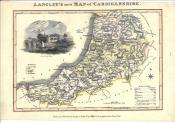
ACM/68 (1818)